Rev. Bras. Ciênc. Solo.2019;43:e0190051.
Assessing Water Erosion Processes in Degraded Area Using Unmanned Aerial Vehicle Imagery
Paulo Siqueira Junior ![]() , Marx Leandro Naves Silva
, Marx Leandro Naves Silva ![]() , Bernardo Moreira Cândido
, Bernardo Moreira Cândido ![]() , Fabio Arnaldo Pomar Avalos
, Fabio Arnaldo Pomar Avalos ![]() , Pedro Velloso Gomes Batista
, Pedro Velloso Gomes Batista ![]() , Nilton Curi
, Nilton Curi ![]() , Wellington de Lima
, Wellington de Lima ![]() , John Norman Quinton
, John Norman Quinton ![]()
07/out/2019
DOI: 10.1590/18069657rbcs20190051
Resumo Gráfico
Destaques
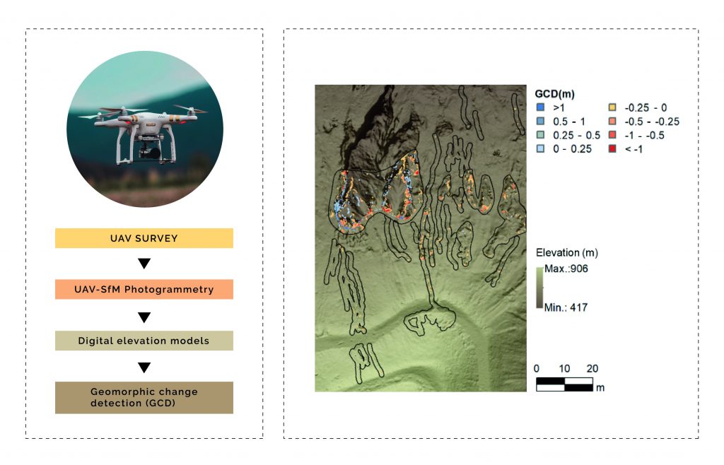
The use of Unmanned Aerial Vehicles (UAVs) and Structure from Motion (SfM) techniques can contribute to increase the accessibility, accuracy, and resolution of Digital Elevation Models (DEMs).
SfM can be used to acquire high-resolution topography in order to derive accurate monitoring of soil erosion.
This is a novel research in Brazil and contributes to the study of the dynamics of soil erosion in time and space.
ABSTRACT
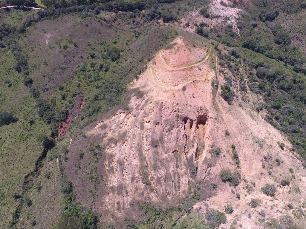
The use of Unmanned Aerial Vehicles (UAVs) and Structure from Motion (SfM) techniques can contribute to increase the accessibility, accuracy, and resolution of Digital Elevation Models (DEMs) used for soil erosion monitoring. This study aimed to evaluate the use of four DEMs obtained over a year to monitor erosion processes in an erosion-degraded area, with occurrence of rill and gully erosions, and its correlation with accumulated rainfall during the studied period. The DEMs of Geomorphic Change Detection (GCD) of horizontal and vertical resolutions of 0.10 and 0.06 m were obtained. It was possible to detect events of erosion and deposition volumes of the order of 2 m3, with a volumetric error of ∼50 %, in rills and gullies in the initial stage denominated R and GS-I, respectively. Events of the order of 100 m3, with a volumetric error around 14 % were found for advanced gullies, a segment denominated GS-II. In the three studied erosion situations, the deposition volume increased with the accumulated rainfall. The segments R and GS-I presented an inverse relationship between erosion volume and accumulated rainfall during the studied period. This behaviour can be explained by the dynamics of the deposition and erosion volumes during the erosion process. In the GS-II segment, erosion and deposition volumes were proportional and a direct relation with the cumulative rainfall over the studied period and a low percentage of volumetric error were found.
384