

Hydropedological digital mapping: machine learning applied to spectral VIS-IR and radiometric data dimensionality reduction
Priscilla Azevedo dos Santos ![]() , Helena Saraiva Koenow Pinheiro
, Helena Saraiva Koenow Pinheiro ![]() , Waldir de Carvalho Carvalho
, Waldir de Carvalho Carvalho ![]() , Igor Leite da Silva
, Igor Leite da Silva ![]() , Nilson Rendeiro Pereira
, Nilson Rendeiro Pereira ![]() , Silvio Barge Bhering
, Silvio Barge Bhering ![]() , [...]
, [...]
03/out/2023
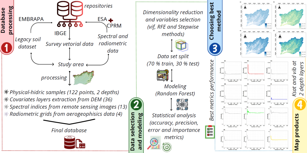
ABSTRACT Pedosphere-hydrosphere interface accounts for the association between soil hydrology and landscape, represented by topographic and Remote Sensing data support and integration. This study aimed to analyze different statistical radiometric and spectral data selection methods and dimensionality reduce environment-related data to support the classification of soil physical-hydric properties, such as soil basic infiltration rate (bir) and saturated hydraulic conductivity (Ksat); as well as to act in data mining processes applied to hydropedological properties digital mapping. Accordingly, research integrated information from […]
Digital soil mapping for the Parnaíba River delta, Brazilian semiarid region
João Victor Alves Amorim ![]() , Gustavo Souza Valladares
, Gustavo Souza Valladares ![]() , Marcos Gervasio Pereira
, Marcos Gervasio Pereira ![]() , Mirya Grazielle Torres Portela
, Mirya Grazielle Torres Portela ![]() , Andréa Maciel Lima
, Andréa Maciel Lima ![]()
04/abr/2023
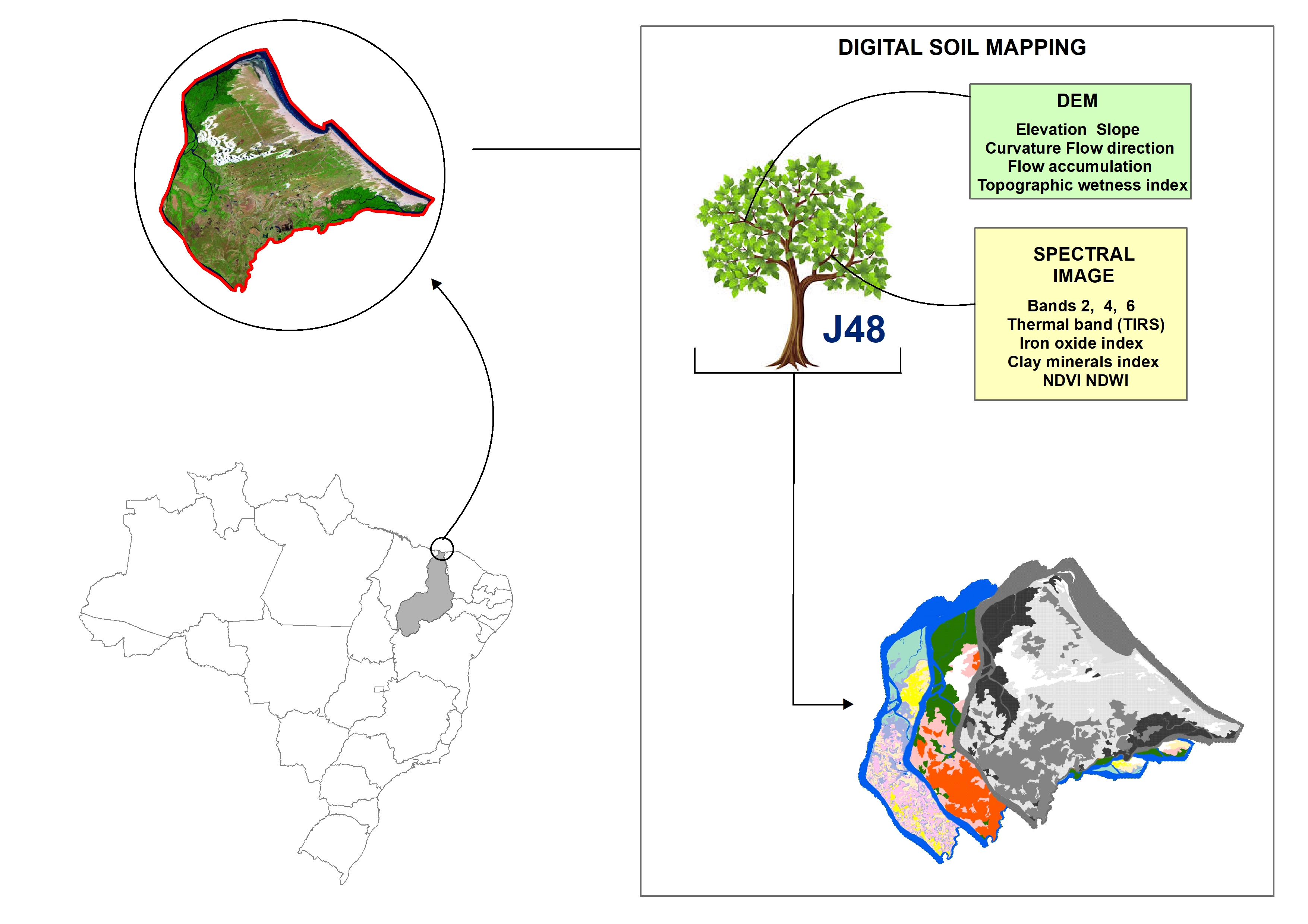
ABSTRACT Soil mapping is a permanent demand, but the traditional method does not allow fast execution and low cost. Digital soil mapping (DSM) aims to improve the process by working with models that treat soil spatial variability quantitatively. In this perspective, the objective of the study is to perform DSM of the Parnaíba River Delta, Northeastern Brazil, through the decision tree (DT) integration technique using a set of attributes derived from the digital elevation model (DEM) and satellite images as […]
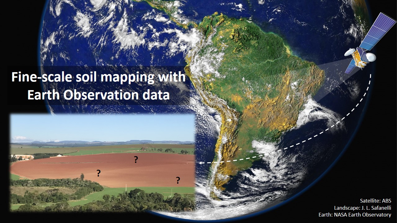
Fine-scale soil mapping with Earth Observation data: a multiple geographic level comparison
José Lucas Safanelli ![]() , José Alexandre Melo Demattê
, José Alexandre Melo Demattê ![]() , Natasha Valadares dos Santos
, Natasha Valadares dos Santos ![]() , Jorge Tadeu Fim Rosas
, Jorge Tadeu Fim Rosas ![]() , Nélida Elizabet Quiñonez Silvero
, Nélida Elizabet Quiñonez Silvero ![]() , Benito Roberto Bonfatti
, Benito Roberto Bonfatti ![]() , [...]
, [...]
24/nov/2021
ABSTRACT Multitemporal collections of satellite images and their products have recently been explored in digital soil mapping. This study aimed to produce a bare soil image (BSI) for the São Paulo State (Brazil) to perform a pedometric analysis for different geographical levels. First, we assessed the potential of the BSI for predicting the surface (0.00-0.20 m) and subsurface (0.80-1.00 m) clay, iron oxides (Fe 2 O 3 ), aluminum (m%) and bases saturation (V%) contents at the state level, which […]
Satellite Spectral Data on the Quantification of Soil Particle Size from Different Geographic Regions
12/set/2018
ABSTRACT: The study of soils, including their physical and chemical properties, is essential for agricultural management. Soil quality must be maintained to ensure sustainable production of food and conservation of natural resources. In this context, soil mapping is important to provide spatial information, which can be performed using remote sensing (RS) techniques. Modeling through use of satellite data is uncertain regarding the amplitude of replicability of the models. The aim of this study was to develop a quantification model for […]
Integração de dados do quickbird e atributos do terreno no mapeamento digital de solos por redes neurais artificiais
01/jun/2011
No presente estudo, foi realizada uma avaliação de diferentes variáveis ambientais no mapeamento digital de solos em uma região no norte do Estado de Minas Gerais, utilizando redes neurais artificiais (RNA). Os atributos do terreno declividade e índice topográfico combinado (CTI), derivados de um modelo digital de elevação, três bandas do sensor Quickbird e um mapa de litologia foram combinados, e a importância de cada variável para discriminação das unidades de mapeamento foi avaliada. O simulador de redes neurais utilizado […]