

Soil legacy data: An opportunity for digital soil mapping
Beatriz Macêdo Medeiros ![]() , Letícia Sequinatto Rossi
, Letícia Sequinatto Rossi ![]() , Alexandre ten Caten
, Alexandre ten Caten ![]() , Gustavo Eduardo Pereira
, Gustavo Eduardo Pereira ![]() , Elisângela Benedet da Silva
, Elisângela Benedet da Silva ![]() , Kelly Tamires Urbano Daboit
, Kelly Tamires Urbano Daboit ![]()
23/jul/2024
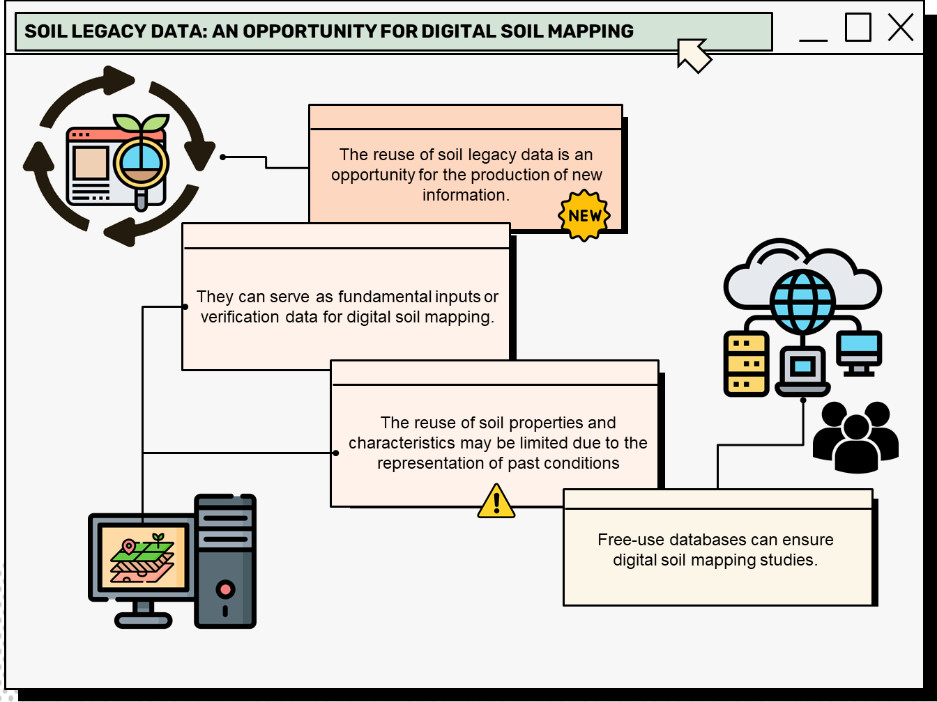
ABSTRACT Soil legacy data is past information on soils available from various sources (e.g. survey reports and maps). When compiled and organized, data obtained through historical retrieval can be used as basic input or validation data for digital soil mapping. A bibliometric analysis of this topic can reveal research patterns, evolution, and scientific contribution, thus mapping the science produced in a specific period and determining the trend in research topics based on search terms. This article presents the characterization of […]
Disposal of solid waste from civil construction: a screening proposal for a suitability system and case study in Nepomuceno, Minas Gerais
Luana Sousa Costa ![]() , Marcelo Henrique Procópio Pelegrino
, Marcelo Henrique Procópio Pelegrino ![]() , Bruno Silva Villela
, Bruno Silva Villela ![]() , Maria Eduarda Carvalho Monteiro
, Maria Eduarda Carvalho Monteiro ![]() , Raísa Brito Vilela
, Raísa Brito Vilela ![]() , Daniela de Fátima Pedroso
, Daniela de Fátima Pedroso ![]() , [...]
, [...]
11/mar/2024
ABSTRACT Most Brazilian municipalities do not have regulated areas for solid waste disposal in civil construction. Usually, residues are disposed of vacant lots and dumps, posing risks to the population health and the environment. Soils are the primary means for the disposal or recycling of waste, highlighting the importance of well-characterized soils and their respective landscape. This study aimed to establish a land suitability system for solid residues in civil construction and apply such information in a case study in […]

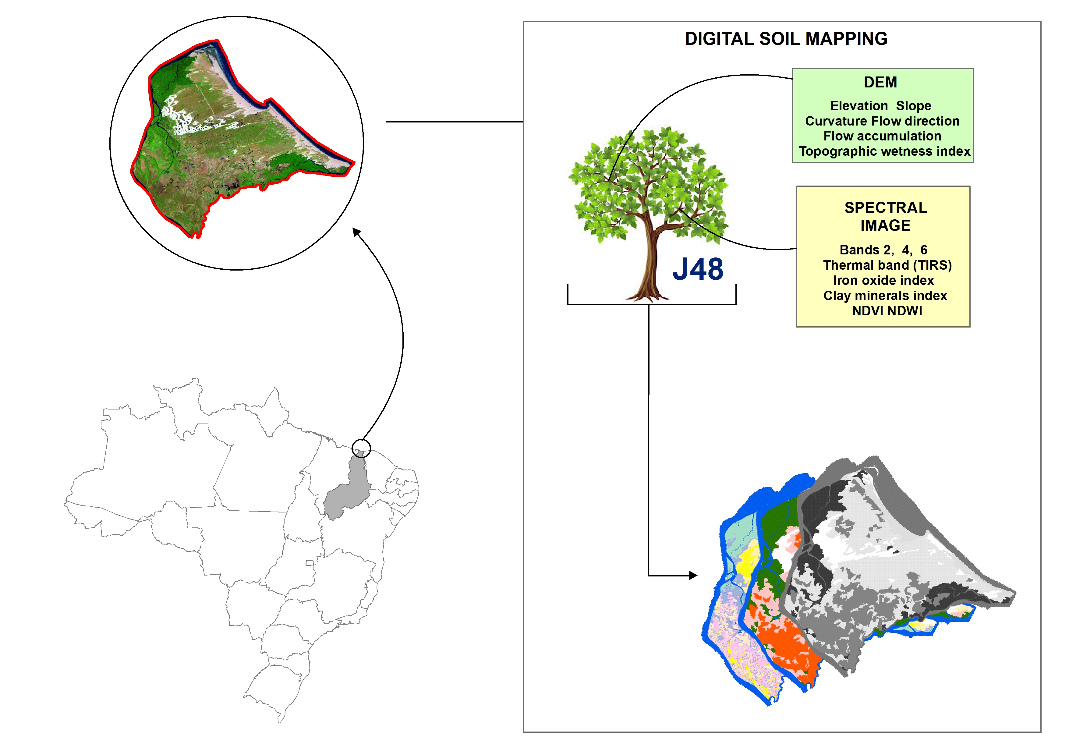
Digital soil mapping for the Parnaíba River delta, Brazilian semiarid region
João Victor Alves Amorim ![]() , Gustavo Souza Valladares
, Gustavo Souza Valladares ![]() , Marcos Gervasio Pereira
, Marcos Gervasio Pereira ![]() , Mirya Grazielle Torres Portela
, Mirya Grazielle Torres Portela ![]() , Andréa Maciel Lima
, Andréa Maciel Lima ![]()
04/abr/2023
ABSTRACT Soil mapping is a permanent demand, but the traditional method does not allow fast execution and low cost. Digital soil mapping (DSM) aims to improve the process by working with models that treat soil spatial variability quantitatively. In this perspective, the objective of the study is to perform DSM of the Parnaíba River Delta, Northeastern Brazil, through the decision tree (DT) integration technique using a set of attributes derived from the digital elevation model (DEM) and satellite images as […]
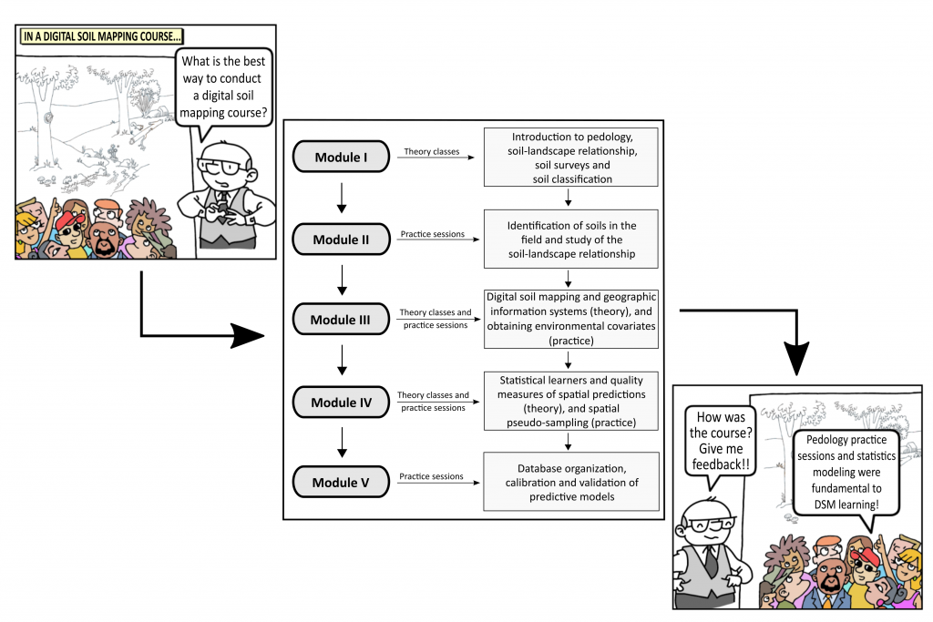
How is the learning process of digital soil mapping in a diverse group of land use planners?
Ricardo Simão Diniz Dalmolin, Jean Michel Moura-Bueno, Alessandro Samuel-Rosa ![]() , Carlos Alberto Flores
, Carlos Alberto Flores ![]()
03/fev/2020
ABSTRACT The use of new technologies, the development of new software, and the advances in the machines ability to process data have brought a new perspective to soil science and especially to pedology, with the advent of digital soil mapping (DSM). To meet the demand for soil surveys in Brazil, it will be necessary to popularize the techniques used in DSM. To identify and map the soil to generate maps of land use capability, we proposed a theoretical and practical […]
Mapping Soil Cation Exchange Capacity in a Semiarid Region through Predictive Models and Covariates from Remote Sensing Data
15/out/2018
ABSTRACT: Planning sustainable use of land resources requires reliable information about spatial distribution of soil physical and chemical properties related to environmental processes and ecosystemic functions. In this context, cation exchange capacity (CEC) is a fundamental soil quality indicator; however, it takes money and time to obtain this data. Although many studies have been conducted to spatially quantify soil properties on various scales and in different environments, not much is known about interactions between soil properties and environmental covariates in […]
Multinomial Logistic Regression and Random Forest Classifiers in Digital Mapping of Soil Classes in Western Haiti
18/jun/2018
ABSTRACT Digital soil mapping (DSM) has been increasingly used to provide quick and accurate spatial information to support decision-makers in agricultural and environmental planning programs. In this study, we used a DSM approach to map soils in western Haiti and compare the performance of the Multinomial Logistic Regression (MLR) with Random Forest (RF) to classify the soils. The study area of 4,300 km2 is mostly composed of diverse limestone rocks, alluvial deposits, and, to a lesser extent, basalt. A soil […]
Método do hipercubo latino condicionado para a amostragem de solos na presença de covariáveis ambientais visando o mapeamento digital de solos
01/abr/2014
A amostragem é uma das etapas mais importantes dos levantamentos de solos. No entanto, os esquemas de amostragem utilizados nos levantamentos convencionais têm se evidenciado inadequados para o mapeamento digital de solos, pois podem comprometer os resultados e, além disso, não possibilitam a realização de análises estatísticas. Este estudo teve por objetivo avaliar o método de amostragem do hipercubo latino condicionado (cLHS, sigla em inglês), na presença de covariáveis ambientais (elevação, declividade, curvatura e mapa de uso e cobertura do […]
Volume de dados adequado para o mapeamento digital de solos no município de Erechim, Rio Grande do Sul, Brasil
01/abr/2013
Informações digitais tornam possível um elevado grau de redundância das informações disponíveis para o ajuste de modelos preditores aplicados ao Mapeamento Digital de Solos (MDS). Entre esses modelos, a técnica de Árvores de Decisão (AD) tem aplicação crescente, em razão da sua potência no tratamento de grandes volumes de dados. Objetivou-se com este trabalho avaliar o impacto do volume de dados utilizados para gerar os modelos por AD, na qualidade dos mapas de solos gerados pela técnica de MDS. Uma […]
Perfis de carbono orgânico do solo nas regiões Sul e Serra do Espinhaço Meridional, Minas Gerais: modelagem em profundidade
01/nov/2012
Apesar de o interesse no comportamento espacial de atributos-chave do solo, só recentemente a variação em profundidade passou a receber mais atenção na literatura. O carbono orgânico do solo (COS) é talvez o atributo que mais varie em profundidade, o que dificulta seu estudo. A partir de dados de levantamentos de solos de duas regiões de Minas Gerais (Sul e Serra do Espinhaço Meridional), foram modelados os teores de COS em profundidade, buscando identificar quais fatores mais os influenciam. Os […]
Mapa digital de solos: estratégias para processamento de dados
01/ago/2012
Mapas de solos têm na borda dos polígonos a região de maior variabilidade, o que leva os pedólogos a divergir quanto ao delineamento das classes de solos nesses locais. O objetivo deste estudo foi propor uma estratégia de pré-processamento de dados aplicada ao mapeamento digital de solos. Polígonos de solos em um mapa de treinamento foram deslocados para seu interior em 100 e 160 m. Essa estratégia possibilitou que covariáveis localizadas próximas à borda das classes de solos não fossem […]