Rev. Bras. Ciênc. Solo.2023;47:e0220149.
Hydropedological digital mapping: machine learning applied to spectral VIS-IR and radiometric data dimensionality reduction
Priscilla Azevedo dos Santos ![]() , Helena Saraiva Koenow Pinheiro
, Helena Saraiva Koenow Pinheiro ![]() , Waldir de Carvalho Carvalho
, Waldir de Carvalho Carvalho ![]() , Igor Leite da Silva
, Igor Leite da Silva ![]() , Nilson Rendeiro Pereira
, Nilson Rendeiro Pereira ![]() , Silvio Barge Bhering
, Silvio Barge Bhering ![]() , Marcos Bacis Ceddia
, Marcos Bacis Ceddia ![]()
03/Oct/2023
DOI: 10.36783/18069657rbcs20220149
Graphical Abstract
Highlights
Drastic reduction in input variables amount from 53 to ≤ 37 at both soil horizons.
Iron oxide was the most selected spectral index by methods (20-0.40 m horizons).
VIF presented the most effective data dimensionality reduction.
RFE and Stepwise AIC obtained better quality metrics at Random Forest modeling.
Radiometry data was important to soil composition analysis at a superficial level.
ABSTRACT
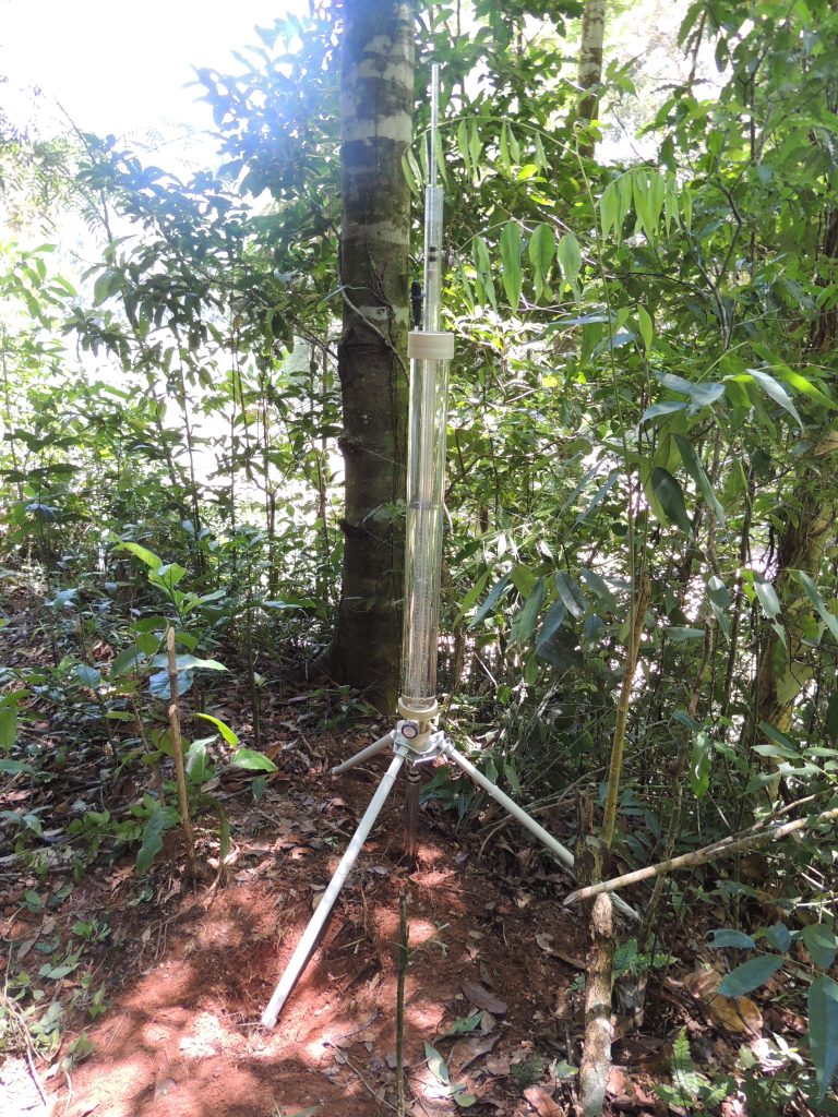
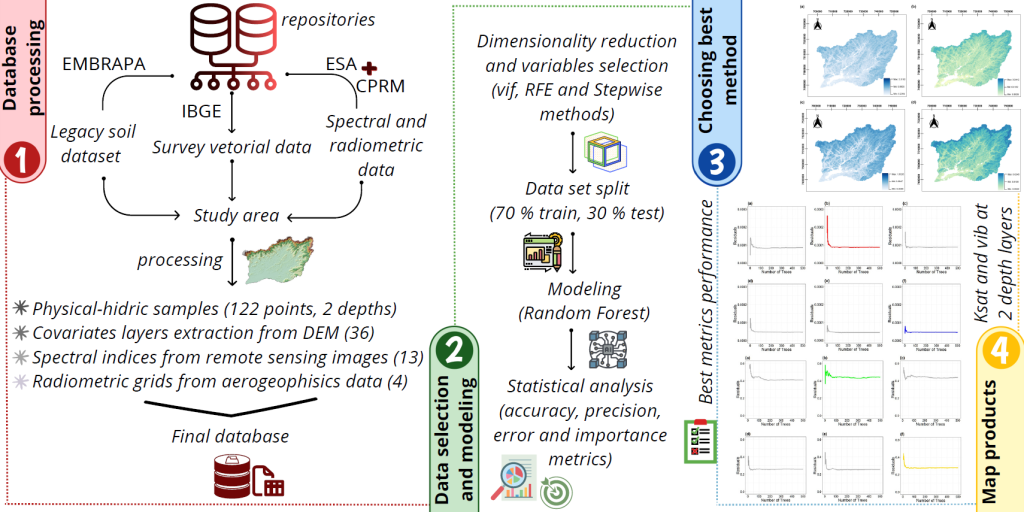
Pedosphere-hydrosphere interface accounts for the association between soil hydrology and landscape, represented by topographic and Remote Sensing data support and integration. This study aimed to analyze different statistical radiometric and spectral data selection methods and dimensionality reduce environment-related data to support the classification of soil physical-hydric properties, such as soil basic infiltration rate (bir) and saturated hydraulic conductivity (Ksat); as well as to act in data mining processes applied to hydropedological properties digital mapping. Accordingly, research integrated information from Visible to Infrared (VIS-IR) spectral indices and Sentinel’s 2A mission Multispectral Instrument (MSI) sensor bands, terrain numerical modeling and aerogeophysics set to model soil-water content in two soil layers (0.00-0.20 m and 0.20-0.40 m). Pre-processed data were subjected to statistical analysis (multivariate and hypothesis tests); subsequently, the methods were applied (variation inflation factor – VIF, Stepwise Akaike information criterion – Stepwise AIC, and recursive feature elimination – RFE) to mine covariates used for Random Forest modeling. Based on the results, there were distinctions and singularities in spectral and radiometric data selection for each adopted method; the importance degree, and contribution of each one to soil physical-hydric properties have varied. According to the applied statistical metrics and decision-making criteria (highest R2 and lowest RMSE / MAE), the chosen methods were RFE (0.00-0.20 m layers) and Stepwise AIC (0.20-0.40 m layers) – both concerned with the assessed variables (bir and Ksat). This approach captured the importance of environmental variables and highlighted their potential use in hydropedological digital mapping at Guapi-Macacu watershed.
189