1 results
Assessing Water Erosion Processes in Degraded Area Using Unmanned Aerial Vehicle Imagery
Paulo Siqueira Junior ![]() , Marx Leandro Naves Silva
, Marx Leandro Naves Silva ![]() , Bernardo Moreira Cândido
, Bernardo Moreira Cândido ![]() , Fabio Arnaldo Pomar Avalos
, Fabio Arnaldo Pomar Avalos ![]() , Pedro Velloso Gomes Batista
, Pedro Velloso Gomes Batista ![]() , Nilton Curi
, Nilton Curi ![]() , [...]
, [...]
07/Oct/2019
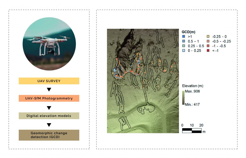
ABSTRACT The use of Unmanned Aerial Vehicles (UAVs) and Structure from Motion (SfM) techniques can contribute to increase the accessibility, accuracy, and resolution of Digital Elevation Models (DEMs) used for soil erosion monitoring. This study aimed to evaluate the use of four DEMs obtained over a year to monitor erosion processes in an erosion-degraded area, with occurrence of rill and gully erosions, and its correlation with accumulated rainfall during the studied period. The DEMs of Geomorphic Change Detection (GCD) of […]