

Developing scoring functions to assess soil quality at a regional scale in rangelands of SW Spain
Manuel Pulido Fernández ![]() , Ali Keshavarzi
, Ali Keshavarzi ![]() , Jesús Rodrigo-Comino
, Jesús Rodrigo-Comino ![]() , Susanne Schnabel
, Susanne Schnabel ![]() , Joaquín Francisco Lavado Contador
, Joaquín Francisco Lavado Contador ![]() , Álvaro Gómez Gutiérrez
, Álvaro Gómez Gutiérrez ![]() , [...]
, [...]
06/Nov/2020
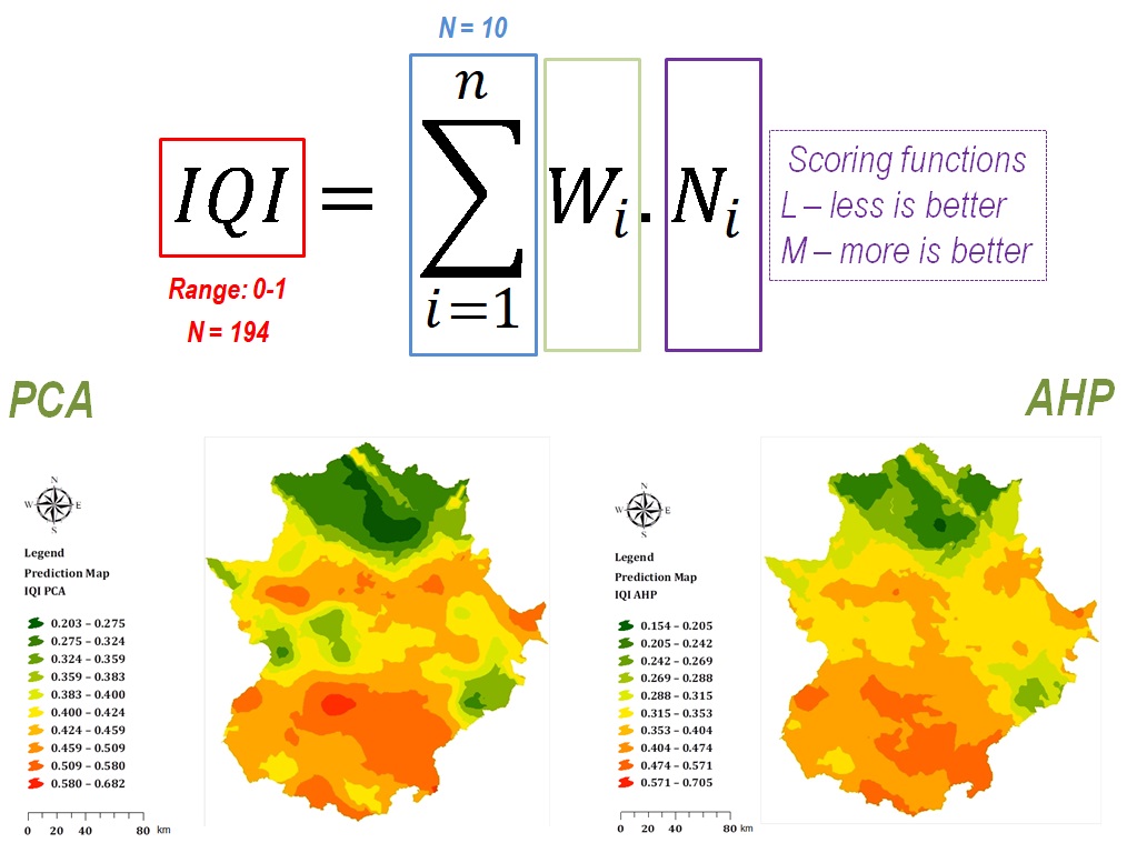
ABSTRACT The drawing of maps of soil quality at a large scale is increasingly being more useful to land planners and stakeholders. Nevertheless, it involves different methodological steps from the description of soil profiles in the field until the regional mapping of integrative soil quality index (IQI) values. The development of proper scoring functions is a paramount task for the calculation of these IQI values since every parameter needs to be standardized accordingly and weighting factors are usually estimated by […]
PRODUCTION OF A SOIL MAP ASSOCIATING COMMON DIGITAL SOIL MAPPING TECHNIQUES WITH HAND DELINEATION OF SOIL MAPPING UNITS
01/Jul/2015
The production of soil maps through digital soil mapping (DSM) techniques may be hampered due to the lack of traditional reference soil maps. In these situations, the tacit knowledge of the field soil scientist can be used for manual delineation of soil mapping units (MUs) based on generation of a map of occurrence of soil types predicted by DSM. The objective of this study was to evaluate and to compare soil maps generated by two methods. One method, called “direct […]