
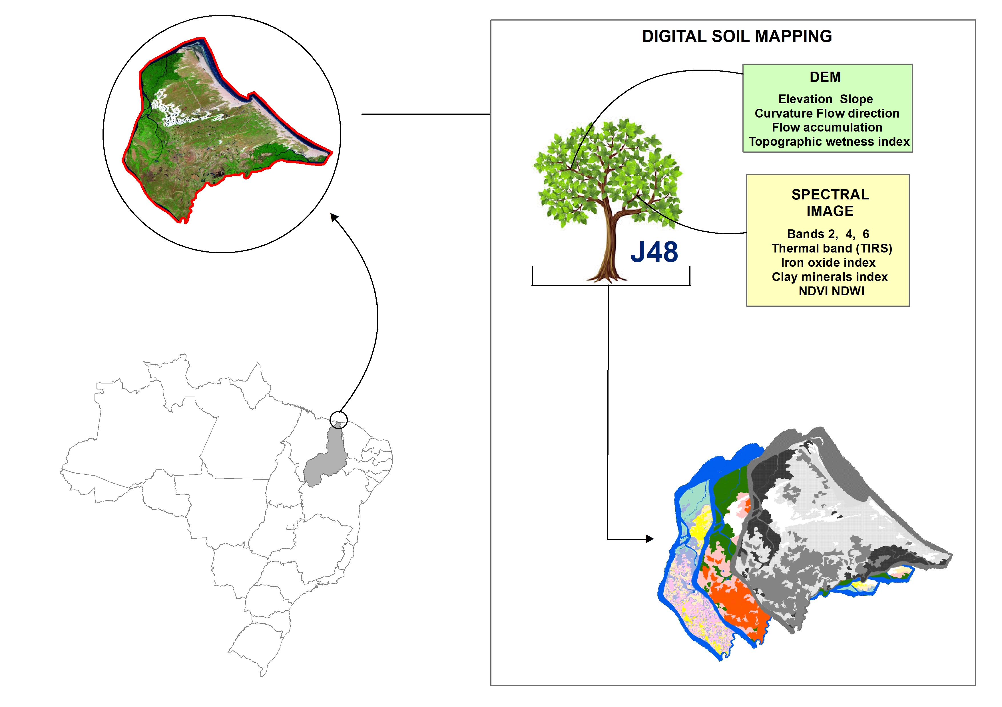
Digital soil mapping for the Parnaíba River delta, Brazilian semiarid region
João Victor Alves Amorim ![]() , Gustavo Souza Valladares
, Gustavo Souza Valladares ![]() , Marcos Gervasio Pereira
, Marcos Gervasio Pereira ![]() , Mirya Grazielle Torres Portela
, Mirya Grazielle Torres Portela ![]() , Andréa Maciel Lima
, Andréa Maciel Lima ![]()
04/Apr/2023
ABSTRACT Soil mapping is a permanent demand, but the traditional method does not allow fast execution and low cost. Digital soil mapping (DSM) aims to improve the process by working with models that treat soil spatial variability quantitatively. In this perspective, the objective of the study is to perform DSM of the Parnaíba River Delta, Northeastern Brazil, through the decision tree (DT) integration technique using a set of attributes derived from the digital elevation model (DEM) and satellite images as […]
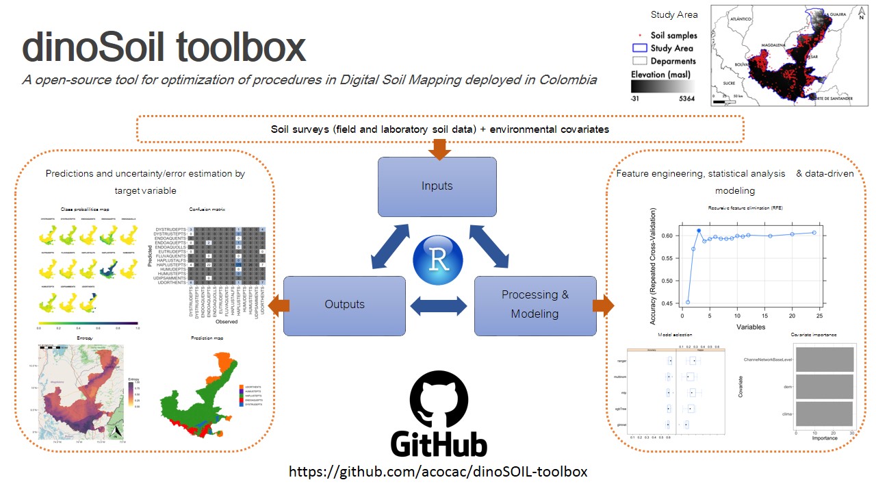
Optimized data-driven pipeline for digital mapping of quantitative and categorical properties of soils in Colombia
Alejandro Coca-Castro ![]() , Joan Sebastián Gutierrez-Díaz
, Joan Sebastián Gutierrez-Díaz ![]() , Victoria Camacho
, Victoria Camacho ![]() , Andrés Felipe López
, Andrés Felipe López ![]() , Patricia Escudero
, Patricia Escudero ![]() , Pedro Karin Serrato
, Pedro Karin Serrato ![]() , [...]
, [...]
24/Nov/2021
ABSTRACT Soil maps provide a method for graphically communicating what is known about the spatial distribution of soil properties in nature. We proposed an optimized pipeline, named dino-soil toolbox, programmed in the R software for mapping quantitative and categorical properties of legacy soil data. The pipeline, composed of four main modules (data preprocessing, covariates selection, exploratory data analysis and modeling), was tested across a study area of 14,537 km 2 located between the departments of Cesar and Magdalena, Colombia. We […]
Selection of Environmental Covariates for Classifier Training Applied in Digital Soil Mapping
26/Nov/2018
ABSTRACT A large number of predictor variables can be used in digital soil mapping; however, the presence of irrelevant covariables may compromise the prediction of soil types. Thus, algorithms can be applied to select the most relevant predictors. This study aimed to compare three covariable selection systems (two filter algorithms and one wrapper algorithm) and assess their impacts on the predictive model. The study area was the Lajeado River Watershed in the state of Rio Grande do Sul, Brazil. We […]