1 results
Optimized data-driven pipeline for digital mapping of quantitative and categorical properties of soils in Colombia
Alejandro Coca-Castro ![]() , Joan Sebastián Gutierrez-Díaz
, Joan Sebastián Gutierrez-Díaz ![]() , Victoria Camacho
, Victoria Camacho ![]() , Andrés Felipe López
, Andrés Felipe López ![]() , Patricia Escudero
, Patricia Escudero ![]() , Pedro Karin Serrato
, Pedro Karin Serrato ![]() , [...]
, [...]
24/Nov/2021
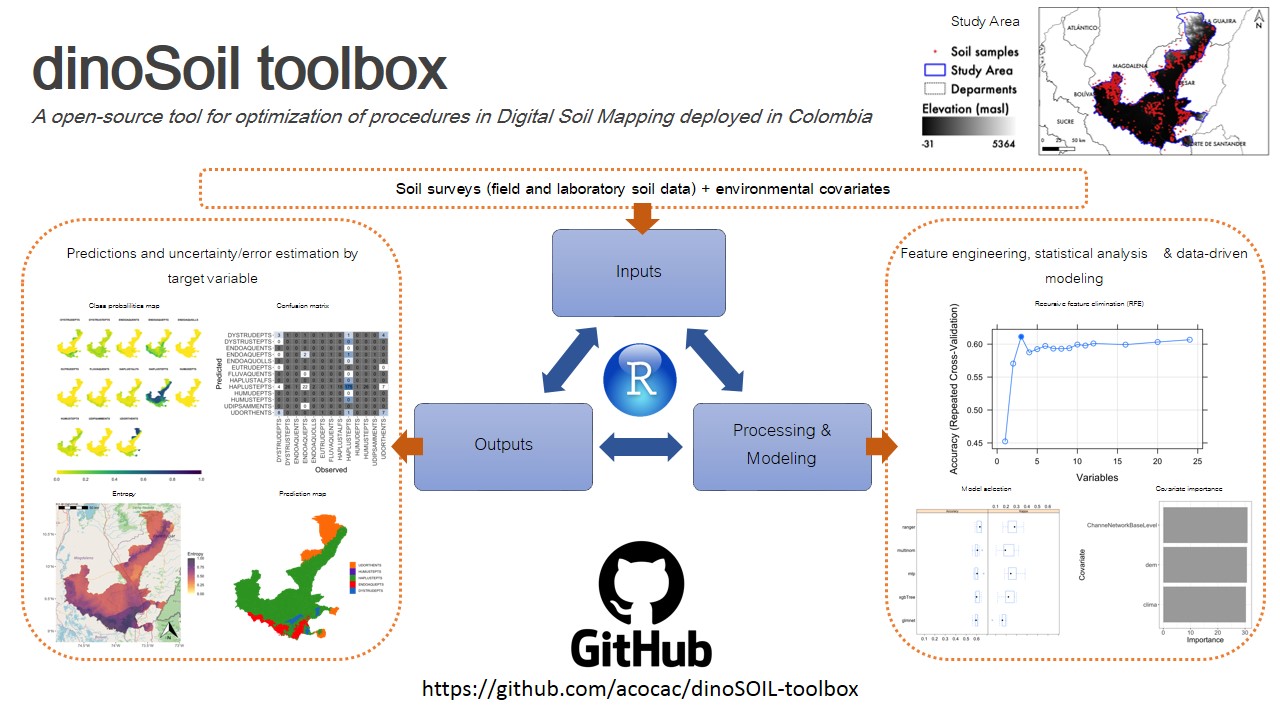
ABSTRACT Soil maps provide a method for graphically communicating what is known about the spatial distribution of soil properties in nature. We proposed an optimized pipeline, named dino-soil toolbox, programmed in the R software for mapping quantitative and categorical properties of legacy soil data. The pipeline, composed of four main modules (data preprocessing, covariates selection, exploratory data analysis and modeling), was tested across a study area of 14,537 km 2 located between the departments of Cesar and Magdalena, Colombia. We […]