

Sediment source and volume of soil erosion in a gully system using UAV photogrammetry
Bernardo Moreira Cândido ![]() , Mike James
, Mike James ![]() , John Quinton
, John Quinton ![]() , Wellington de Lima
, Wellington de Lima ![]() , Marx Leandro Naves Silva
, Marx Leandro Naves Silva ![]()
11/Nov/2020
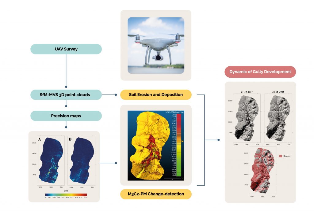
ABSTRACT Gully erosion is a severe way of land degradation. Gullies threaten the sustainability of agro-ecosystems, causing quantitative and qualitative reduction of groundwater, farmland productivity, and waterways sedimentation. Since the gully development on the surface begins with water flow and sheet erosion, accurate monitoring of the erosive processes in a gully system and its quantification is key for the development of effective strategies to control soil erosion in gullies. Here, we demonstrate the first use of unmanned aerial vehicle (UAV) […]
Typology and distribution of erosion processes in a microwatershed of the Ribeirão Água da Cachoeira from Paraguaçú Paulista, São Paulo state, Brazil
01/Mar/1998
With the objective of defining the typology and distribution of the predominant erosion processes in a “Água da Cachoeira” microwatershed, with 3.700 ha, located in the “Planalto Ocidental Paulista”, a survey, characterization and mapping of erosion was conducted. Areas with sheet erosion, sheet and rill erosion, deep rill and gully erosion, and badlands were delimited through photointerpretation and field work. Four large badlands connected to the drainage net, eight wide gullies with partial vegetation cover and several average gullies which […]