

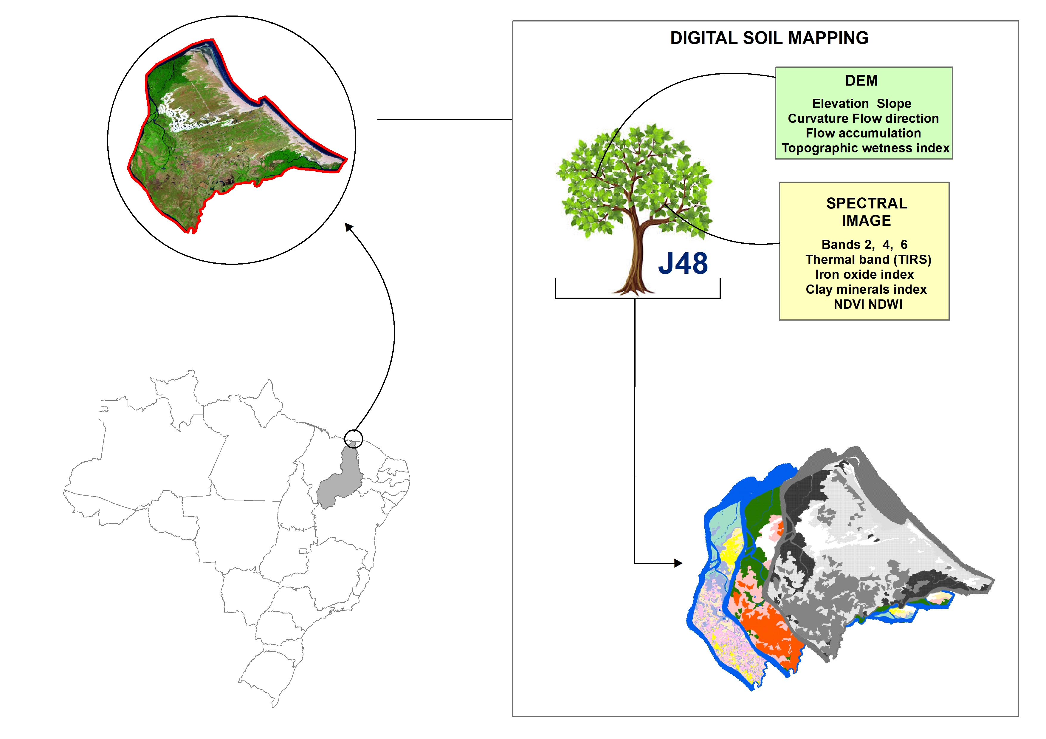
Digital soil mapping for the Parnaíba River delta, Brazilian semiarid region
João Victor Alves Amorim ![]() , Gustavo Souza Valladares
, Gustavo Souza Valladares ![]() , Marcos Gervasio Pereira
, Marcos Gervasio Pereira ![]() , Mirya Grazielle Torres Portela
, Mirya Grazielle Torres Portela ![]() , Andréa Maciel Lima
, Andréa Maciel Lima ![]()
04/Apr/2023
ABSTRACT Soil mapping is a permanent demand, but the traditional method does not allow fast execution and low cost. Digital soil mapping (DSM) aims to improve the process by working with models that treat soil spatial variability quantitatively. In this perspective, the objective of the study is to perform DSM of the Parnaíba River Delta, Northeastern Brazil, through the decision tree (DT) integration technique using a set of attributes derived from the digital elevation model (DEM) and satellite images as […]
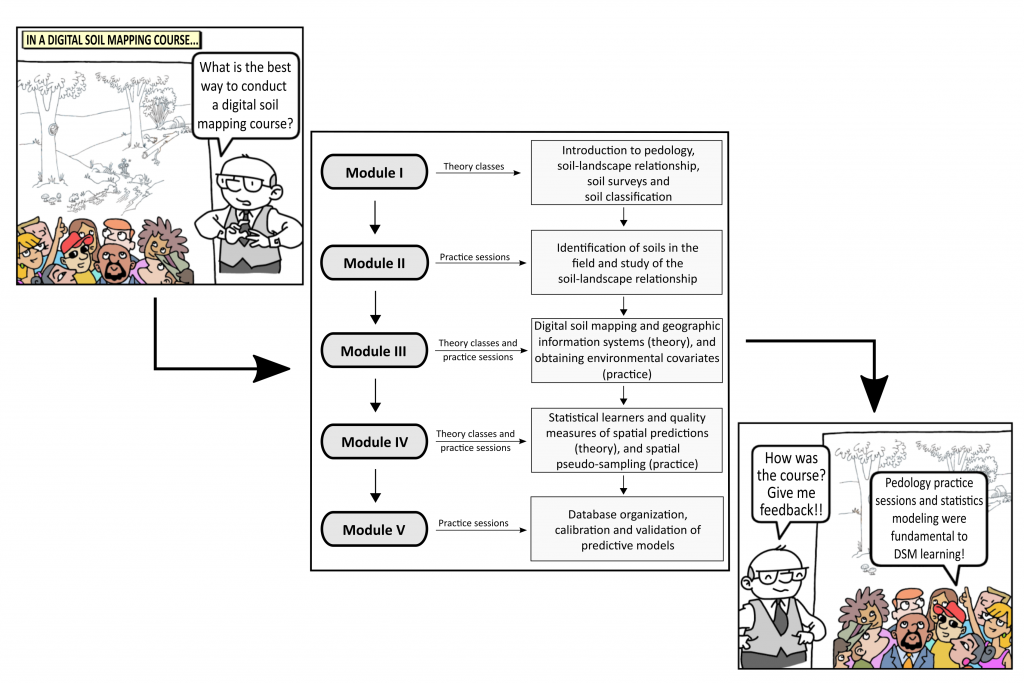
How is the learning process of digital soil mapping in a diverse group of land use planners?
Ricardo Simão Diniz Dalmolin, Jean Michel Moura-Bueno, Alessandro Samuel-Rosa ![]() , Carlos Alberto Flores
, Carlos Alberto Flores ![]()
03/Feb/2020
ABSTRACT The use of new technologies, the development of new software, and the advances in the machines ability to process data have brought a new perspective to soil science and especially to pedology, with the advent of digital soil mapping (DSM). To meet the demand for soil surveys in Brazil, it will be necessary to popularize the techniques used in DSM. To identify and map the soil to generate maps of land use capability, we proposed a theoretical and practical […]
An appropriate data set size for digital soil mapping in Erechim, Rio Grande do Sul, Brazil
01/Apr/2013
Digital information generates the possibility of a high degree of redundancy in the data available for fitting predictive models used for Digital Soil Mapping (DSM). Among these models, the Decision Tree (DT) technique has been increasingly applied due to its capacity of dealing with large datasets. The purpose of this study was to evaluate the impact of the data volume used to generate the DT models on the quality of soil maps. An area of 889.33 km² was chosen in […]
Geostatistical simulation for the spatial characterization of iron oxides in different landforms
01/Dec/2012
The clay minerals goethite and hematite are iron oxides serving as indicators of the soil environment, with great influence on the soil physical and chemical properties. Knowledge of spatial patterns of these oxides can help understand the interrelationships of cause and effect with soil properties. In this sense, the quality of the spatial estimates can affect the results and consequently the interpretation of the spatial patterns. This study aimed to evaluate the performance of the geostatistical estimation methods by ordinary […]
Multiple Logistic Regressions: controlling factors in applications to soil class prediction
01/Feb/2011
More effective methodologies to determine the soil class distribution must be evaluated in order to meet the demand for soil maps at regional and global scales. In this study, logistic regressions were used as predictive models in an application of Digital Soil Mapping. The models were derived from an existing soil map as dependent variable and terrain attributes as independent variables. The probability of finding soil classes in the landscape at the 1st and 2nd Categorical Level of the Brazilian […]