
Simulation of soil organic carbon potential sequestration for high Andes Peruvian croplands
Carlos Carbajal ![]() , Jesús Vera
, Jesús Vera ![]() , Samuel Pizarro
, Samuel Pizarro ![]() , Carlos Mestanza
, Carlos Mestanza ![]()
12/Sep/2025
RESUMO O sequestro de carbono orgânico do solo (COS) em terras agrícolas representa uma oportunidade significativa para mitigar as mudanças climáticas, removendo dióxido de carbono da atmosfera. Ferramentas de simulação são cada vez mais utilizadas para avaliar o impacto das mudanças climáticas e do manejo do solo na dinâmica dos estoques de carbono orgânico do solo. Embora os solos andinos normalmente armazenem grandes quantidades de carbono orgânico, práticas agrícolas, especialmente a aração, podem esgotar esses estoques, criando a necessidade de […]
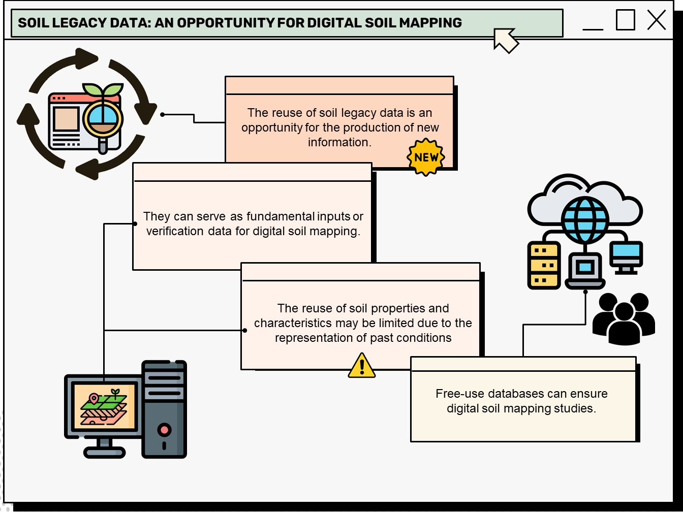
Soil legacy data: An opportunity for digital soil mapping
Beatriz Macêdo Medeiros ![]() , Letícia Sequinatto Rossi
, Letícia Sequinatto Rossi ![]() , Alexandre ten Caten
, Alexandre ten Caten ![]() , Gustavo Eduardo Pereira
, Gustavo Eduardo Pereira ![]() , Elisângela Benedet da Silva
, Elisângela Benedet da Silva ![]() , Kelly Tamires Urbano Daboit
, Kelly Tamires Urbano Daboit ![]()
23/Jul/2024
ABSTRACT Soil legacy data is past information on soils available from various sources (e.g. survey reports and maps). When compiled and organized, data obtained through historical retrieval can be used as basic input or validation data for digital soil mapping. A bibliometric analysis of this topic can reveal research patterns, evolution, and scientific contribution, thus mapping the science produced in a specific period and determining the trend in research topics based on search terms. This article presents the characterization of […]
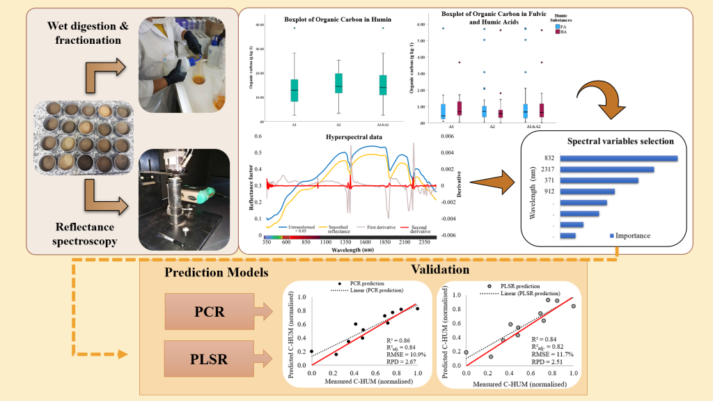
Reflectance spectroscopy in the prediction of soil organic carbon associated with humic substances
Sharon Gomes Ribeiro ![]() , Marcio Regys Rabelo de Oliveira
, Marcio Regys Rabelo de Oliveira ![]() , Letícia Machado Lopes
, Letícia Machado Lopes ![]() , Mirian Cristina Gomes Costa
, Mirian Cristina Gomes Costa ![]() , Raul Shiso Toma
, Raul Shiso Toma ![]() , Isabel Cristina da Silva Araújo
, Isabel Cristina da Silva Araújo ![]() , [...]
, [...]
06/Jun/2023
ABSTRACT Understanding organic carbon and predominant humic fractions in the soil allows contributes to soil quality management. Conventional fractionation techniques require time, excessive sampling, and high maintenance costs. In this study, predictive models for organic carbon in humic substances (HS) were evaluated using hyperspectral data as an alternative to chemical fractionation and quantification by wet digestion. Twenty-nine samples of Neossolos Flúvicos (Fluvents) – A1, and 36 samples of Cambissolos (Inceptisols) – A2 were used. The samples were also analyzed jointly, […]
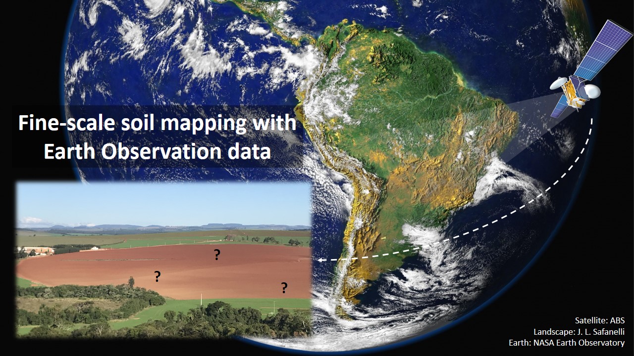
Fine-scale soil mapping with Earth Observation data: a multiple geographic level comparison
José Lucas Safanelli ![]() , José Alexandre Melo Demattê
, José Alexandre Melo Demattê ![]() , Natasha Valadares dos Santos
, Natasha Valadares dos Santos ![]() , Jorge Tadeu Fim Rosas
, Jorge Tadeu Fim Rosas ![]() , Nélida Elizabet Quiñonez Silvero
, Nélida Elizabet Quiñonez Silvero ![]() , Benito Roberto Bonfatti
, Benito Roberto Bonfatti ![]() , [...]
, [...]
24/Nov/2021
ABSTRACT Multitemporal collections of satellite images and their products have recently been explored in digital soil mapping. This study aimed to produce a bare soil image (BSI) for the São Paulo State (Brazil) to perform a pedometric analysis for different geographical levels. First, we assessed the potential of the BSI for predicting the surface (0.00-0.20 m) and subsurface (0.80-1.00 m) clay, iron oxides (Fe 2 O 3 ), aluminum (m%) and bases saturation (V%) contents at the state level, which […]
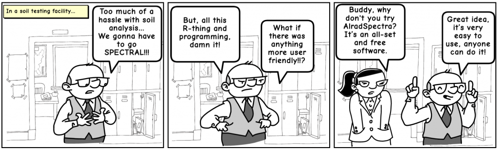
AlradSpectra: a Quantification Tool for Soil Properties Using Spectroscopic Data in R
André Carnieletto Dotto ![]() , Ricardo Simão Diniz Dalmolin
, Ricardo Simão Diniz Dalmolin ![]() , Alexandre ten Caten
, Alexandre ten Caten ![]() , Diego José Gris
, Diego José Gris ![]() , Luis Fernando Chimelo Ruiz
, Luis Fernando Chimelo Ruiz ![]()
23/Jul/2019
ABSTRACT Soil reflectance spectroscopy has become an innovative method for soil property quantification supplying data for studies in soil fertility, soil classification, digital soil mapping, while reducing laboratory time and applying a clean technology. This paper describes the implementation of a Graphical User Interface (GUI) using R named AlradSpectra. It contains several tools to process spectroscopic data and generate models to predict soil properties. The GUI was developed to accomplish tasks such as perform a large range of spectral preprocessing […]
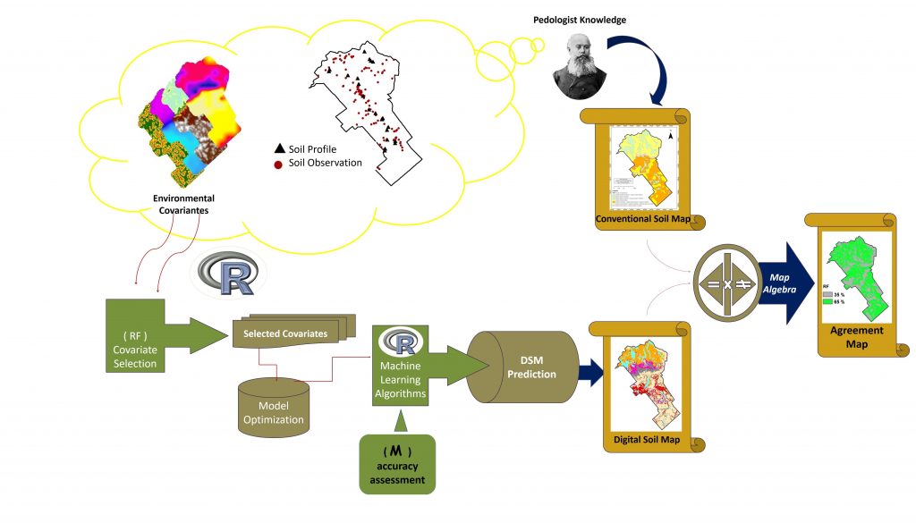
Digital Soil Mapping Using Machine Learning Algorithms in a Tropical Mountainous Area
02/Nov/2018
ABSTRACT: Increasingly, applications of machine learning techniques for digital soil mapping (DSM) are being used for different soil mapping purposes. Considering the variety of models available, it is important to know their performance in relation to soil data and environmental variables involved in soil mapping. This paper investigated the performance of eight machine learning algorithms for soil mapping in a tropical mountainous area of an official rural settlement in the Zona da Mata region in Brazil. Morphometric maps generated from […]
Magnetic Susceptibility of Soil to Differentiate Soil Environments in Southern Brazil
11/Jan/2017
ABSTRACT The interest in new techniques to support digital soil mapping (DSM) is increasing. Numerous studies pointed out that the measure of magnetic susceptibility (MS) can be extremely useful in the identification of properties related with factors and processes of soil formation, applied to soil mapping. This study addressed the effectiveness of magnetic soil susceptibility to identify and facilitate the distinction of different pedogenic environments of a representative hillslope in the highland Planalto Médio in the state of Rio Grande […]
Boundary between Soil and Saprolite in Alisols in the South of Brazil
01/May/2015
Despite numerous studies conducted on the lower limit of soil and its contact with saprolite layers, a great deal of work is left to standardize identification and annotation of these variables in the field. In shallow soils, the appropriately noting these limits or contacts is essential for determining their behavior and potential use. The aims of this study were to identify and define the field contact and/or transition zone between soil and saprolite in profiles of an Alisol derived from […]
Digital mapping of soil properties: particle size and soil organic matter by diffuse reflectance spectroscopy
01/Dec/2014
Diffuse reflectance spectroscopy (DRS) can be used as an alternative in identifying and quantifying some soil properties such as particle size and soil organic matter (SOM). This technique may be an alternative to quantifying those properties in a large volume of soil samples since it is faster and less costly and does not produce chemical residues. The aim of this study was to develop models using multiple linear regression analysis to predict the content of clay, sand, silt, and SOM […]
Digital soil mapping: strategy for data pre-processing
01/Aug/2012
The region of greatest variability on soil maps is along the edge of their polygons, causing disagreement among pedologists about the appropriate description of soil classes at these locations. The objective of this work was to propose a strategy for data pre-processing applied to digital soil mapping (DSM). Soil polygons on a training map were shrunk by 100 and 160 m. This strategy prevented the use of covariates located near the edge of the soil classes for the Decision Tree […]