Rev. Bras. Ciênc. Solo.2023;47:e0220160.
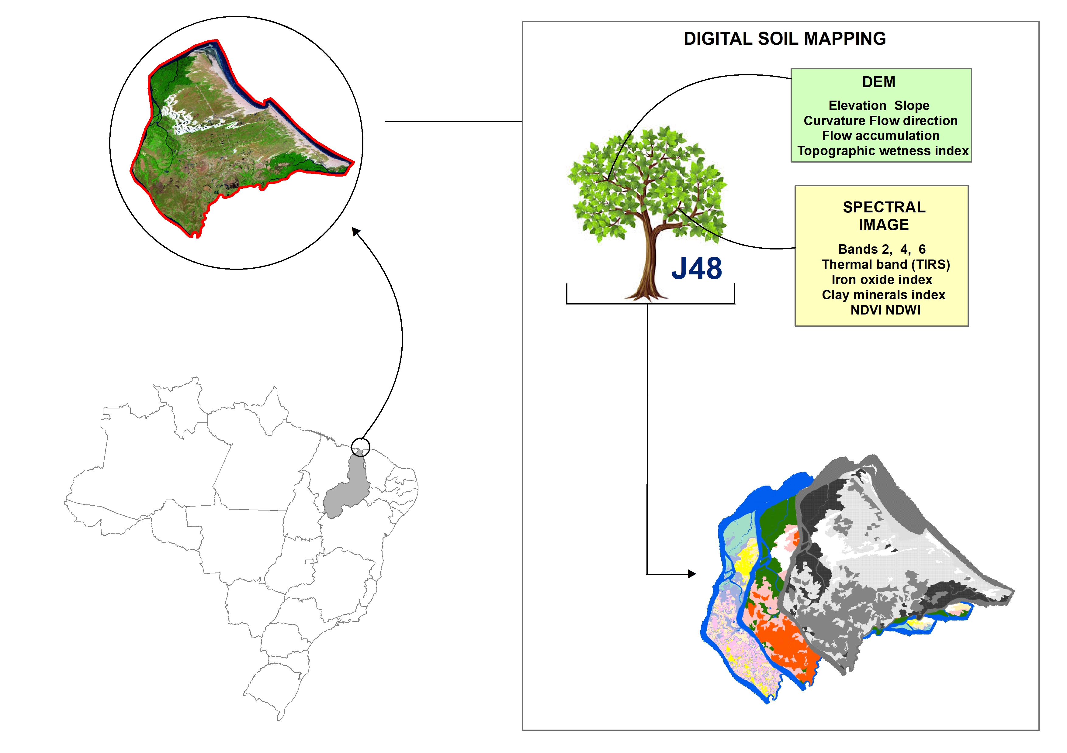
Digital soil mapping for the Parnaíba River delta, Brazilian semiarid region
João Victor Alves Amorim ![]() , Gustavo Souza Valladares
, Gustavo Souza Valladares ![]() , Marcos Gervasio Pereira
, Marcos Gervasio Pereira ![]() , Mirya Grazielle Torres Portela
, Mirya Grazielle Torres Portela ![]() , Andréa Maciel Lima
, Andréa Maciel Lima ![]()
04/Apr/2023
DOI: 10.36783/18069657rbcs20220160
Graphical Abstract
Highlights
This study provides data on pedometrics in northeastern Brazilian estuaries.
Application of spectral indices effectively predicts mappings of low relief plains areas.
J48 algorithm is satisfactory in predicting soils on the Brazilian semiarid coast.
The produced maps have the potential for several environmental studies.
ABSTRACT
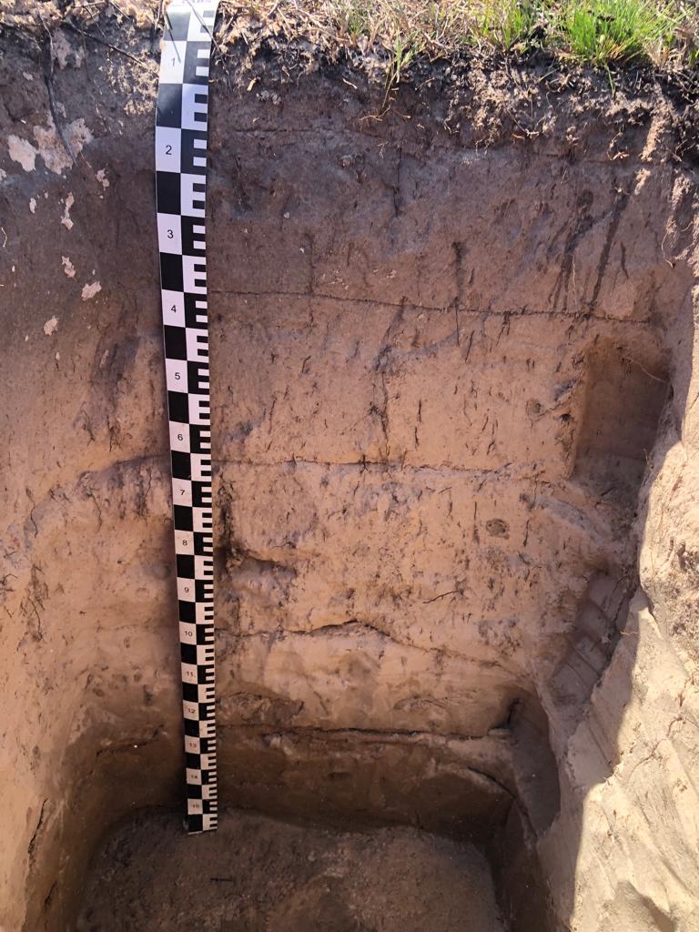
Soil mapping is a permanent demand, but the traditional method does not allow fast execution and low cost. Digital soil mapping (DSM) aims to improve the process by working with models that treat soil spatial variability quantitatively. In this perspective, the objective of the study is to perform DSM of the Parnaíba River Delta, Northeastern Brazil, through the decision tree (DT) integration technique using a set of attributes derived from the digital elevation model (DEM) and satellite images as input parameters. Data matrices were created considering different soil groups. The performance of the J48 machine learning algorithm (DT) was assessed for a set of two data matrices: one elaborated for the mapping units of the pre-existing conventional pedological map and the other for a set of associations determined based on the characteristics of the landscape of the study area with close correlation with the existing soils, mainly due to the source material. From the data processing, digital soil maps were created and validated by means of error matrices, whose reference points were classified in the field and validated using a pre-existing traditional soil map of the area. The results revealed that the attributes derived from satellite images stood out from those derived from DEM in predicting soil groups. Based on the validation coefficients applied (overall accuracy, Kappa index, user’s accuracy and producer’s accuracy), the classification quality was satisfactory, despite the complexity of the environment.
294